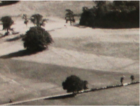
You don’t normally get to see the park from this angle! Looking at these aerial photos (even if it does mean ignoring the Lord of Darkness) shows you just how wonderful and magical Alton Towers actually is, set within hundreds of acres of beautiful countryside!
These are our oldest aerial shots and show what the grounds of Alton Towers looked like prior to the start of its evolution into the theme park that we know today!
Looking towards the lakes you can see some of the early park attractions, the sea lion pool and lakeside bandstand (today behind fences opposite Spinball). Also notice the cars parked on the fields where Towers Street now exists.
Today, beyond the trees pictured in the third photo, you’d be able to see Forbidden Valley and the Resort accommodation – where the trees end is Gloomy Wood.
The fourth photo provides a closer look at the Rapids and Katanga Canyon site. Some of the road running through the bottom of the picture still exists in the maintenance road into Mutiny Bay, and in the fifth photo can be seen the courtyard buildings which are still in the park today.
The road running from left to right through the sixth photo is today Towers Street. The trees towards the bottom of the picture are where the entrance gates now stand.
Above the trees in the seventh photo is the present day site of CBeebies Land. The final photo is of an area which has changed surprisingly little since the 50s – the road leading up the left-hand side of the image is the entrance road to the Resort that still exists today; looking closely you can see the gates in the same location they are today.
During this decade, the Resort opened to the public as a fairground attraction, with these aerial photos capturing these first steps towards becoming a major leisure destination.
Shown is firstly the Alton deer park – the road running through it is that which now takes you to the hotels. A rough comparison between the 1960s and 2006 images is included to show this. Another photo provides a view from Farley looking towards the gardens and lakes. The Fairground is first photographed after the Fun Centre and Talbot Restaurant had been built but before the Penny Arcade. A second photo of the Fairground and Towers from some years later is then also included, where the large Penny Arcade has now been built. The final photo shows the Miniature Railway’s original course as well as the Cable Car station (white building).
It was in this era that Towers Street was built, which remains one of the most iconic parts of the Resort. Take a look back at its construction, from the air!
All of the first three photos were taken in 1986. Pictured first is Aqualand with Towers Street and Kiddies Kingdom in final stages of construction. Second, is the Grand Canyon Rapids in the final stages of construction. The third photo is of Aqualand and Towers Street Construction – note the dark circle where the Big Top has been collapsed. Finally, a photo from 1989, shows the newly built Farmyard, Towers Street and Aqualand.
This was perhaps the most significant decade for the Resort, with the construction of Secret Weapon 3, Nemesis – a ride which put them on the global theme park map.
The first photo, taken in 1991, shows the Rapids and Aqualand before construction of Katanga Canyon and Gloomy Wood. We believe that the next two photos were taken in the early 1990s (possibly 1993), with the first showing the Farmyard before Doodle Doo Derby and Tractor Ride, and the second providing a look at Towers Street, the lakes, and the Towers themselves. Finally we have a photo from 1994 of Nemesis and Thunder Looper – note the lack of the Ride Photography Shop and Nemesis Nosh bus.


